A colossal monument in the bayous
In the northeastern corner of Louisiana, amid the bayous and alluvial plains of the Mississippi, rises one of the most enigmatic prehistoric monuments in the Western Hemisphere. Poverty Point, inscribed on UNESCO's World Heritage List in 2014, is a monumental complex built by hunter-gatherersHunter-gatherersA way of life based on hunting, fishing and gathering wild resources, without farming or herding; it dominated almost the whole of human history.→ living on the banks of Bayou Macon approximately 3,700 years ago. Its scale continues to astonish researchers: six enormous concentric earthen ridges, five monumental mounds, spread across more than 220 hectares.1
What makes Poverty Point particularly fascinating is the apparent contradiction between the architectural complexity of the site and the lifestyle of its builders. In most parts of the world, monuments of this scale were erected by sedentary agricultural societies with hierarchical social organization and food surpluses capable of sustaining specialized labor. Poverty Point was built by hunter-gatherers - populations who did not farm the land and did not necessarily live in permanent villages. At least, that is what was long believed, and this contradiction continues to fuel passionate scientific debate.
The site and its remarkable geometry
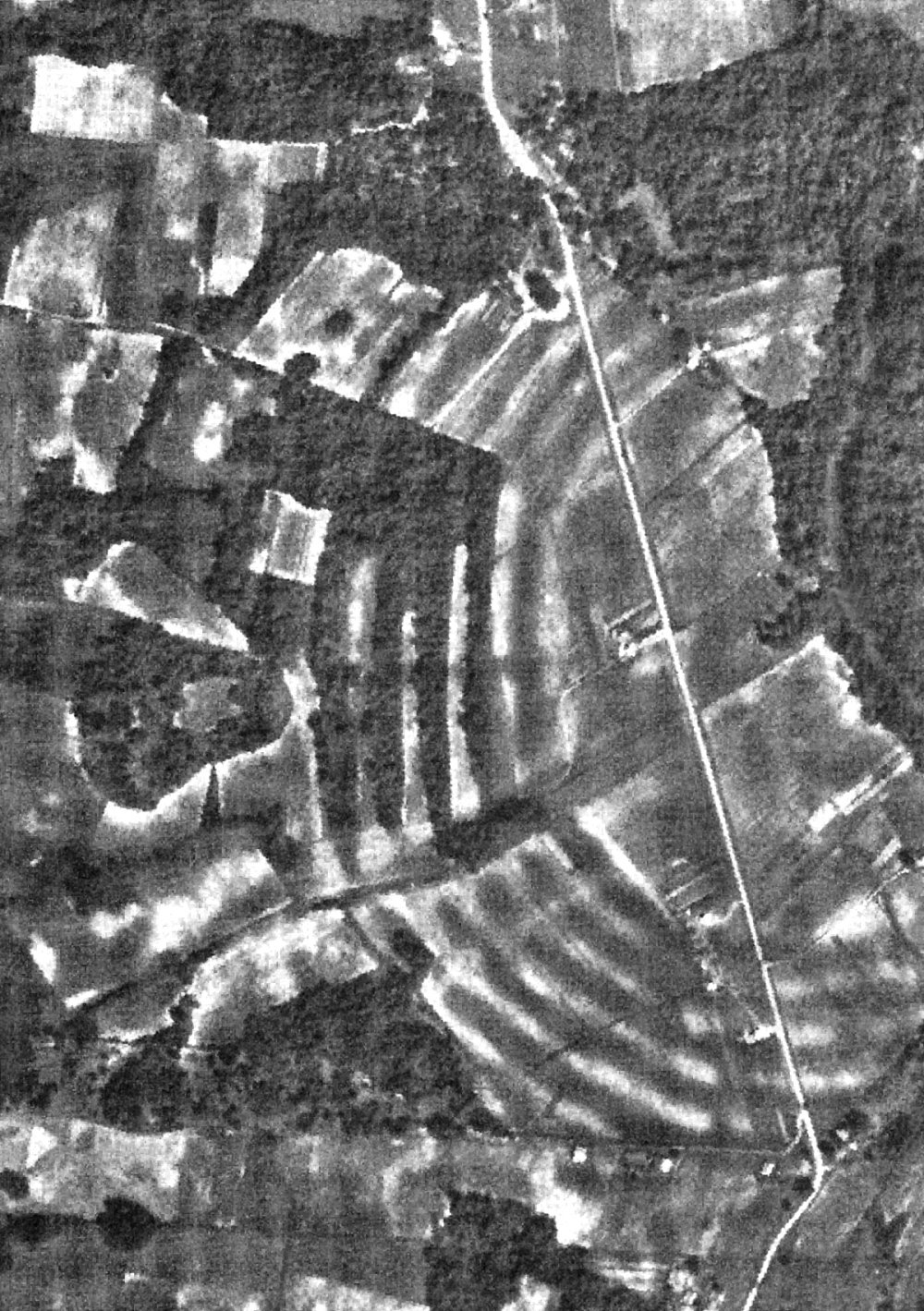
Seen from the air, Poverty Point reveals a striking geometric organization. Six semi-circular earthen ridges nest inside one another like concentric parentheses, oriented toward Bayou Macon to the west. These ridges, some reaching two meters in height and ten meters wide at the base, were probably topped by lightweight structures or houses. The spaces between the ridges may have served as pathways or collective activity areas, creating a kind of village organized concentrically around a central open space.
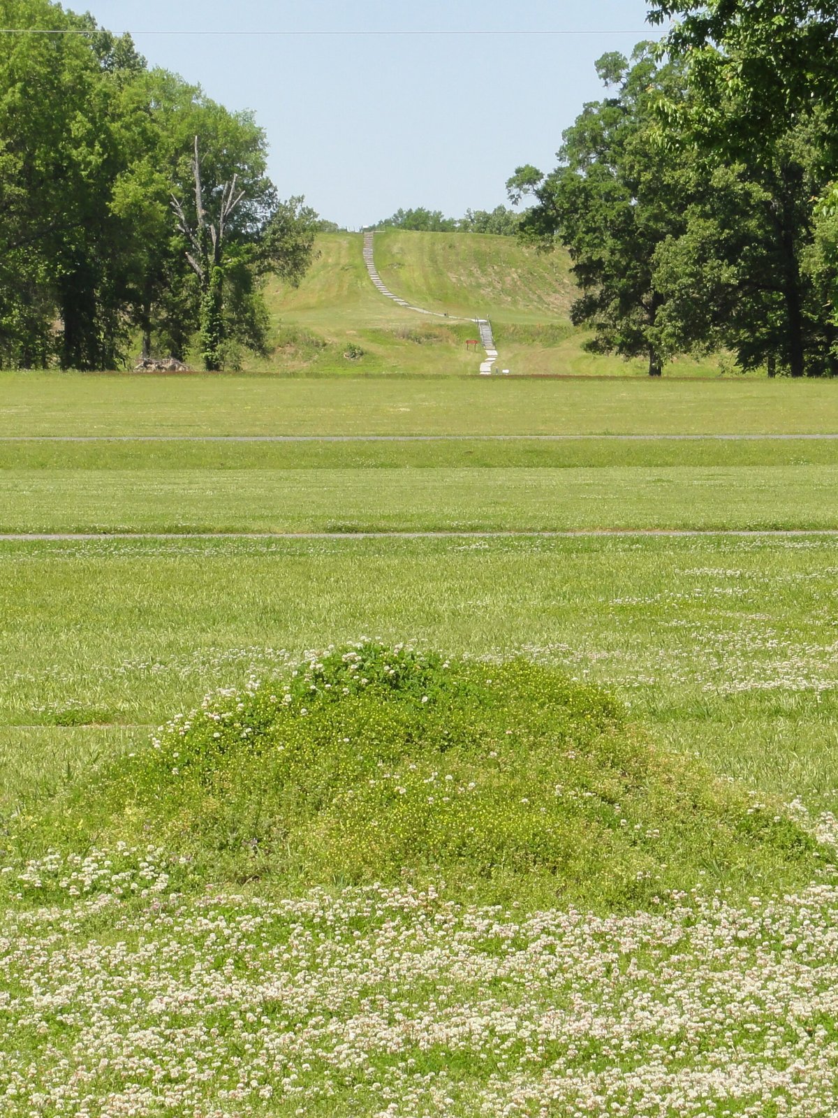
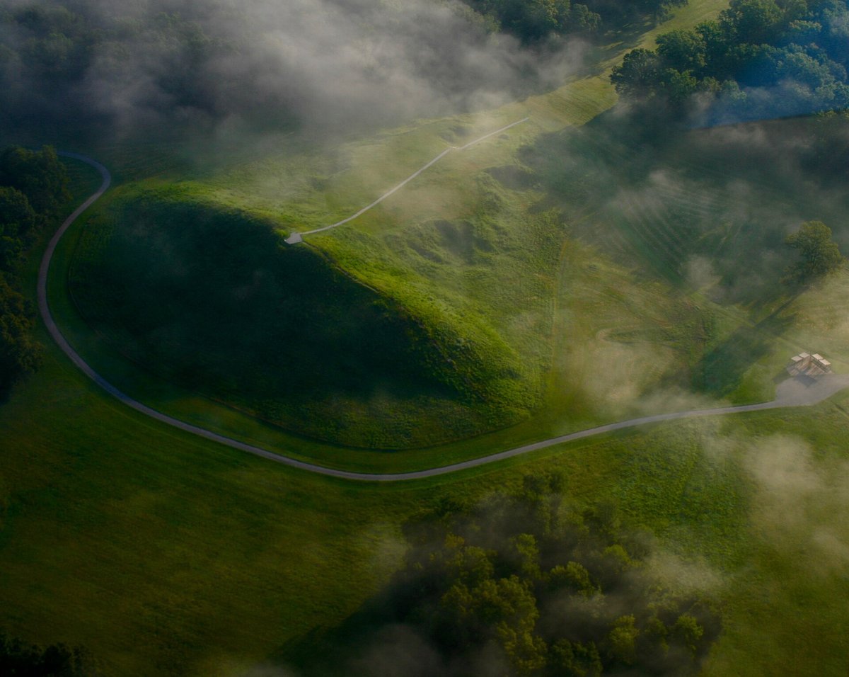
To the southwest of the ring complex stands the largest mound at the site: Mound A, roughly 22 meters high and 200 meters long. By volume, it is comparable to the great pyramids of Central America. Recent geoarchaeological studies suggest it may have been built in just a few weeks, implying an extraordinary mobilization of labor over a short period and a remarkable capacity for social organization. The construction of the entire site required an estimated 750,000 cubic meters of sediment to be moved, transported by hand from borrow areas sometimes several kilometers away.2
Poverty Point Objects: millions of fired clay enigmas
Among the most abundant and mysterious finds at the site are small balls, spheres and varied shapes of dried fired clay, known as Poverty Point Objects, or PPOs. Millions of examples have been found at the site and its immediate surroundings - their abundance is truly astonishing. Their size and shape vary considerably: spheres, cylinders, cones, biconical forms, sometimes bearing deliberate decorative incisions.3
The most widely accepted hypothesis is that these objects were used in cooking. In the absence of ceramic pottery - Poverty Point predates the widespread introduction of ceramics in this region - inhabitants may have heated these small clay balls in a fire, then placed them in pits filled with water or food to cook by thermal transfer. Modern experimental cooking has shown this method to be highly effective for cooking meats, fish and plant foods. Other researchers have proposed alternative uses: slingslingA throwing weapon made of a leather or fibre strap whose pouch, loaded with a projectile, is whirled and released at high speed.→ projectiles, fishing net weights, ritual tokens or exchange currency. The truth is that we do not know with certainty what these millions of objects were used for.
Hunter-gatherers with far-reaching trade networks
Excavations at Poverty Point revealed a particularly unexpected dimension: the site was a node in exchange networks spanning thousands of kilometers. Rocks and minerals from very distant regions were found in large quantities on the site. FlintFlintA hard, brittle siliceous rock, knapped by prehistoric people to produce blades, points and sharp tools.→ and chert came from the Appalachians, over 700 km to the east. Native copper came from the Great Lakes region, over 1,500 km to the north. Galena was found originating from Missouri, soapstone from the Piedmont of North Carolina and Georgia.
This circulation of precious raw materials over such distances was organized, probably through networks of social relationships between communities, gift exchanges or seasonal gatherings. Poverty Point may have functioned as a regular meeting place for populations dispersed over a vast territory, coming together to exchange materials, participate in collective rituals, and perhaps collectively contribute to the construction of the monument during large seasonal gatherings.2
Rethinking hunter-gatherers
Poverty Point forces a fundamental rethinking of received ideas. The capacity to build complex monuments and maintain long-distance exchange networks was long considered the exclusive preserve of agricultural societies. Poverty Point demonstrates that hunter-gatherer populations, under certain favorable conditions - ecological abundance, stable resources, charismatic leadership, appropriate social organization - could accomplish architectural feats comparable to those of well-developed agricultural societies.
The Bayou Macon and Mississippi Delta region offered an exceptionally abundant supply of aquatic and forest resources: fish, shellfish, game, wild fruits and tubers available year-round. This ecological richness may have permitted relative sedentismSedentismThe shift from a nomadic life to lasting settlement in one place, a precondition for the rise of villages.→ and a population density sufficient to mobilize the labor needed to build the site. Fired clay figurines representing humans - many apparently representing women - were also found at the site, suggesting a developed ritual and symbolic life far removed from the simplistic image of "mere hunter-gatherers."4
World heritage and conservation challenges
Inscribed on UNESCO's World Heritage List in 2014, Poverty Point is managed as a Louisiana state park open to the public. The site faces significant conservation challenges: recurring floods from Bayou Macon and the Mississippi, agricultural activities on neighboring lands, the gradual erosion of the earthen ridges and climateClimateThe long-term average atmospheric conditions of a region; its variations (glaciations, aridifications) shaped migrations, agriculture and the collapse of prehistoric societies.→ change all threaten the integrity of the monument. Monitoring and physical restoration programs are underway to stabilize the structures.
Archaeological research continues with increasingly sophisticated methods. Airborne LiDAR technologyLiDARLaser-based remote sensing (from "Light Detection And Ranging"): a sensor fires light pulses and measures the echo's return time to map a surface in three dimensions. Mounted on a plane or a drone, it slips through gaps in the canopy and reconstructs the bare-earth relief, revealing structures invisible beneath vegetation.→ has made it possible to map the site's micro-topography with millimetric precision and to detect prehistoric structures previously invisible beneath dense vegetation. Modern excavations, conducted with an interdisciplinary approach combining archaeology, geoarchaeology and biological analyses, continue to yield surprises and fuel debates about the exact nature of this remarkable site. Poverty Point remains one of the most fascinating enigmas of prehistoric America.1
No comments yet. Be the first.